Geoanalytics, GIS and Remote Sensing

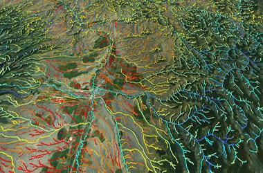
In a rapidly changing global world, our geoanalytical methods transform spatial data to information for human well-being. The cluster members are committed to improving the applicability and adaptability of geoanalytical methods including spatial modelling, GIS, and remote sensing to advance our understanding of geographical questions. Our research focuses on digital terrain analysis, hydrological modelling, remote sensing, spatial statistics, and travel behaviour studies. We develop and apply advanced geospatial techniques to provide immediate and efficient actions for our pressing environmental and urban problems.


GRF Project (PI: Qiming Zhou) Assessment of water resource change over Central Asian aridzone using remote sensing, global hydrological models and machine learning approach
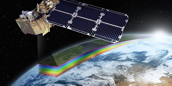
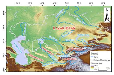
This project is to seek the solution for better estimating the change of water resources in Central Asian aridzone. The aim of this project is two-folds: (1) to develop a new methodology to assess and simulate regional terrestrial water storage anomalies (TWSA), and (2) to reveal the spatiotemporal pattern of water resources for the evaluation of the impacts by climate change and human activities on the water cycle over Central Asian aridzone. Two scientific questions/issues will be addressed. First, can the change of TWSA, hence the components of the regional water resource, be monitored more efficiently and practically by integrating remote sensing technology and global hydrological models (GHMs)? Second, what is the eco-hydrological response of the regional water cycle, which is revealed by the application of above integrated approach, to climate change and human activity in Central Asian aridzone? A new and innovative approach is proposed to derive TWSA by the assimilation and integration of Gravity Recovery and Climate Experiment (GRACE) data and the global hydrological models (GHMs). The proposed TWSA estimation methodology overcomes the drawbacks of GHMs due to their uncertainties caused by the limited availability of in situ observations as the model inputs, and the restricted applicability due to structural limits of the model. On the other hand, the proposed approach also seek the solution to improve the TWSA assessment by the GRACE alone, which the short time series and coarse spatial resolution are widely identified as major limits in application. Three research outcomes are expected, including (1) a TWSA estimation method by the assimilation and integration of GRACE and GHM, which, with the proper calibration and validation, can be applied to water resource applications in an arid environment at a regional scale; (2) an improved TWSA dataset covering Central Asian aridzone with a better spatial resolution and longer time series, and derived hydrological components of water cycle such as soil moisture, groundwater, snow water equivalent and ice; and (3) a better understanding about the relationships between the regional water resources and climate change and human activity in Central Asian aridzone. Scientific evidences and advices can therefore be provided to the local policy maker in sustainable water resource management, which is a core element to achieve for solving the international water resource disputes between Central Asian states.


GRF Project (PI: Dr Jianfeng Li) Compound Floods from Upstream River Discharge, Localized Rainstorm and Storm Surge across the Pearl River Delta Megacity Region: Risks, Changes and Mechanisms
This study is intended to develop high-quality datasets of river discharge, localized precipitation, and sea level. Joint flood risk analysis will be conducted to estimate the probabilistic behaviors of compound floods, as well as how they have changed in the past several decades over the PRD.
The proposed study will develop high-quality datasets of river discharge, localized precipitation, and sea level. Joint flood risk analysis will be conducted to estimate the probabilistic behaviors of compound floods, as well as how they have changed in the past several decades over the PRD. Synoptic weather conditions during different types of compound floods will be analyzed to understand the mechanisms of these extreme events. Numerical simulations based on physically-based hydrological model and regional weather model will be carried out to evaluate how land use changes influence compound floods by altering land-atmosphere interactions and surface hydrological characteristics. The objectives of the proposed study are: (1) to evaluate risks of compound floods from high river discharge, localized rainstorm and/or storm surge across the PRD; (2) to estimate spatio-temporal changes in compound floods due to climate change and rapid urbanization across the PRD, and; (3) to unravel the mechanisms of compound floods in terms of weather conditions and land use changes. The study outcomes will provide strong scientific support for developing multi-flood management strategies and plans for the PRD and other coastal megacity regions in China.


Zhou, Q. and Li, J., 2020, Geo-spatial analysis in hydrology, ISPRS International Journal of Geo-Information, 9, 435; doi:10.3390/ijgi9070435
With the increasing demand for accurate and reliable hydrological information, geo-spatial analysis plays a more and more important role in hydrological studies. The development of the geo-spatial technique advances our understanding of the complex and spatially heterogeneous hydrological systems. Meanwhile, how to efficiently and effectively process and analyze multi-source geo-spatial data has become more challenging in the fields of hydrology. In this editorial, we first review the development and application of geo-spatial analysis in three major topics in hydrological studies, namely the scaling issue, extraction of basin characteristics, and hydrological modelling. We hence introduce the articles of the Special Issue. These studies present the latest results of geo-spatial analysis in different topics in hydrology, and improve geo-spatial analytic methods for better accuracy and reliability.


Hu, Z., Q. Zhou, X. Chen, D. Chen, J. Li, M. Guo, G. Yin, and Z. Duan, 2019, Groundwater depletion estimated from GRACE: A challenge of sustainable development in an arid region of Central Asia. Remote Sensing, 11(16), 1908
Under climate change and increasing water demands, groundwater depletion has become regional and global threats for water security, which is an indispensable target to achieving sustainable developments of human society and ecosystems, especially in arid and semiarid regions where groundwater is a major water source. In this study, groundwater depletion of 2003–2016 over Xinjiang in China, a typical arid region of Central Asia, is assessed using the gravity recovery and climate experiment (GRACE) satellite and the global land data assimilation system (GLDAS) datasets. In the transition of a warm-dry to a warm-wet climate in Xinjiang, increases in precipitation, soil moisture and snow water equivalent are detected, while GRACE-based groundwater storage anomalies (GWSA) exhibit significant decreasing trends with rates between-3.61 ± 0.85 mm/a of CSR-GWSA and −3.10 ± 0.91 mm/a of JPL-GWSA. Groundwater depletion is more severe in autumn and winter. The decreases in GRACE-based GWSA are in a good agreement with the groundwater statistics collected from local authorities. However, at the same time, groundwater abstraction in Xinjiang doubled, and the water supplies get more dependent on groundwater. The magnitude of groundwater depletion is about that of annual groundwater abstraction, suggesting that scientific exploitation of groundwater is the key to ensure the sustainability of freshwater withdrawals and supplies. Furthermore, GWSA changes can be well estimated by the partial least square regression (PLSR) method based on inputs of climate data. Therefore, GRACE observations provide a feasible approach for local policy makers to monitor and forecast groundwater changes to control groundwater depletion.